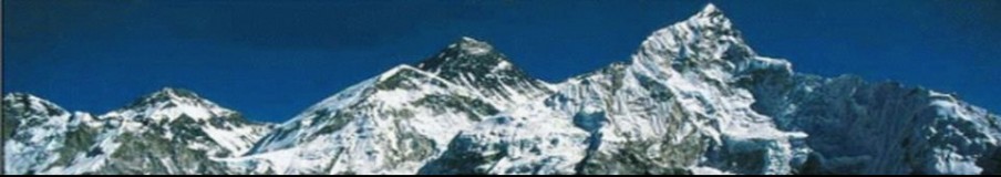
Polish winter expedition to Gasherbrum I 2011/2012, part4.
Winter expedition starts! The expedition is going to operate from December 2011 to March 2012 and climb via classic route leads from the west side and in the upper parts goes through the so-called “Japanese Couloir”, situated in the highest part of the north-west face. This route is the aim of the expedition, whose main task is to ascend in winter for the first time in history the eleventh highest mountain in the world.

Polish winter expedition to Gasherbrum I 2011_2012 – route
Polish winter expedition to Gasherbrum I 8,068 m led by Artur Hajzer ,

the team : Adam Bielecki, Agnieszka Bielecka, Janusz Gołąb.
Report of January 27, 2012, Friday
Adam Bielecki after spending a night in camp 1.
- Report of January 27, 2012, Friday
- Wind at 6,000 m above sea level – 30 km/h, at 7,000 m above sea level – 45 km/h (yesterday at 6,000 m it blew with 45 km/h)
- Cloudiness 100%; clouds’ level – 6,200 m above sea level
- No snowfall (approx. 15 cm of snow fell at night)
- Temperature in the base camp is -20°C (yesterday at 6,000 m it was -30°C)
Yesterday at 4:30 PM local time, Adam Bielecki together with two high altitude porters, Ali and Shaheen, established camp 1 at 5,930 m above sea level. Today at 6 AM local time Artur and Janusz have set off to transport a part of deposit to camp 1 and tomorrow they are going to make a reconnaissance of a route towards camp 2. Today Adam, Shaheen and Ali have descended to the base camp at approximately 2 PM. 
Adam describes yesterday’s set off in the following way:
We set off at 6:40 AM and already at 9:30 AM, after a fast march, we reached the place, where we left our deposit two days ago. It turned out that the deposit place was only 30 minutes away from the so-called lower plateau, through which our route led. The route was not very difficult despite the cracks covered with snow. However, the next glacial barrier turned out to be difficult in terms of finding one’s way and very dangerous – each of us fell into a crack at least ones and Ali even experienced a 4-meter fall into one of them. A route through numerous brittle snow bridges and ice walls led us to the upper plateau. Its terrain seemed technically easy – almost flat snow surface, however, it turned out that the plateau was transected with very wide, parallel cracks that forced us to weave our way and follow our footsteps back in order to walk around the cracks. It was impossible to walk around one of them, thus we had to walk down to its bottom (approx. 40 m) and search for an exit on the other side. We managed to find it after approx. 300 m of walking on the bottom of the crack!
Weather conditions were gradually worsening during the day, what basically meant increasingly stronger wind. Camp 1 was reached at approx. 4:30 PM; we put up a tent while copying with a very strong wind. In practice it meant a constant fight with possible frostbites; after every single activity we had to warm up our fingers. At approx. 6:00 PM we could rest in our sleeping bags; we were too exhausted to eat.
Although today in the morning our footsteps have been partly covered with snow, GPS has helped us to find our way back without problems. At approx. 11:00 AM, halfway through the lower plateau, we have met Janusz and Artur, given them the GPS with the marked route to camp 1, wished them luck and after three hours reached the base camp; on our way we have also rigged the ropes next to two especially nasty cracks.
At the time of writing this report (4:40 PM), Artur and Janusz are approx. one hour away from camp 1.
Saved from an unplanned bivouac by a gps
In one of our first reports we described the icefall: how it changed, how difficult it was and that we covered 70% of the road at this stage. However, we were wrong. As it turned out, we covered only 30% of it and the rest was equally difficult. The difficulty did not lie with rubble or seracs; the main problem was to find a way through the gigantic crevasses. The team consisting in Bielecki, Sadpara and Baig that on 26th January established camp 1 showed great strength and determination.
On 27th January Janusz Gołąb and me (Artur Hajzer) followed them. We set off, according to the rules, at 6 AM. Adam informed us via radio that the route leading to camp 1 had been long and exhausting and that probably we would fail to make it to camp 1, but if we planned to do so, we had to take with us a light assault tent and be prepared for a bivouac. We felt insulted. We would not make it? By following a route? By following their footsteps? What was going on? Was Adam pulling my leg?
We met Adam’s descending team between the icefalls at approx. 11:30 AM. Adam went on talking: “Guys it’s far away! It may happen that you won’t manage to get there. I’ll give you my GPS.” And he gave it to us. We took it with a slight idea about how to use it and continued walking. We were ascending while Adam, Ali and Shaheen were descending. We walked … and walked … and walked … and walked between the blocks of seracs, in ice canyons and between various crevasses. Unfortunately, on the hard patches of the upper plateau weak traces of crampons of Adam’s team were invisible. We could not follow their traces. There were also no tracers, because at this stage Adam’s team had already used all of them and they did not have a possibility to mark the entire route. The hike was getting complicated. The route was meandering often into the opposite direction than the presumed camp.
At approx. 4:00 PM the things got serious. We realized that the day was coming to an end and the camp was nowhere to be seen. Moreover, we were not sure if we were on the right track. The only things left were the GPS and necessity to speed up our pace. The GPS showed only a thin green line (the route marked by Adam) and a white triangle (us). The picture kept on rotating, but as long as the triangle was on the green line we felt safe. At 5:00 PM it grew dark and the GPS indicated that we were not too far away from the camp. We started to run regardless of crevasses that we mostly managed to jump over. Once my body fell into an abyss, but Janusz successfully blocked the rope, I got out and we continued the run. It got dark. We stared at the GPS. Adam told us over the radio how to zoom in the picture and use the GPS to show us the camp in a straight line. We zoomed in. According to the GPS, the camp was 200 m away. However, we could not modify the setting of the GPS so that it showed the camp in the straight line. We were running round in circles – it went without saying that it was an aimless activity. At 6:30 PM it was completely dark. We pored over the GPS. We stopped to move, wet PrimaLoft® overalls lost their heating properties; we started to shiver. We used the GPS by means of a tip of an ice axe or bare fingers. One minute – Janusz, one minute – me. Adam told us to enter the menu and use “find.” The GPS was misty; I could not read the small letters on the screen. Janusz took over the device and also failed to locate “find.” It was getting colder and colder; I warmed up my fingers. Janusz claimed that we could manage to dig a snow pit. We had gas and some food. I zoomed in Adam’s route on the GPS showing that the camp was 48 m away from us. I slowly followed the GPS’ directions and Janusz went after me. I heard Janusz: “It’s there, I can see it on the right!” We found the camp. It was 7:20 PM. We reached the camp – I notified the base camp. In the base camp – where since the last two hours the situation was also tense – everyone relaxed. We put up a tent and everything was fine. In the morning we started to descend to the base camp and it took us an entire day. Taking into account this terrain, it did not matter whether we were going up or down; the pace was almost the same. The route was difficult and far regardless the direction. The situation is completely different in summer. In winter the glacier is more “open.”
All in all, we have camp 1 – so much exhaustion, fear and work and it is only the first camp. What is going to happen at higher altitudes?! For the main fight is to take place above 7,000 m. During our stay in camp 1 we could have a look at a pass leading to camp 2. There is also an open glacier. Hmm … what will happen?
Artur Hajzer

Base camp at the foot of GI, January 30, 2012
Good weather for the summit attempt.
Cloudiness 30%
Temperature -20°C
Wind – weak S/W
No snowfall
Tomorrow Adam Bielecki, Ali and Shaheen are going to leave the base camp in order to try to establish camp 2. Hajzer-Gołąb team is going to act according to their progress. The weather during these days is good the second year in the row. Jet stream moved over the south Pakistan. At 8,000 m above sea level the wind blows with 50 km/h. On 1st February the weather is supposed to be exceptionally good – sunny and without wind. We would not be surprised if other teams attempted the summit and succeeded. However, we would like to remind you that our strategy included attempts at the end of February and the beginning of March. Winter tactics is a roulette, but we believe in our assumptions.
* Source : – http://polskihimalaizmzimowy.pl/
* Previous story :
– Polish winter expedition to Gasherbrum I 2011/2012, part3.
– Polish winter expedition to Gasherbrum I 2011/2012, part2.
– Polish winter expedition to Gasherbrum I 2011/2012, part1.
– Polish winter expedition to Gasherbrum I 2011/2012.
** see :
– Polish winter expedition to Broad Peak 2010/11. Zimowa wyprawa PZA na Broad Peak 2010/11.
– HiMountain winter expedition to Broad Peak – 2008/09 – part 21. HiMountain wyprawa zimowa Broad Peak – 2008/09 – cz.21. /Version english and polish/
– Ice Warriors not give up – HiMountain winter expedition to Broad Peak – 2008/09. HiMountain wyprawa zimowa Broad Peak – 2008/09. /Version english and polish/
– 2007 Winter Nanga Parbat: It’s over – http://www.mounteverest.net/news.php?id=15523
– Polish winter expedition to K2, 2002/3 /Version polish and english/
– Polish-Italian winter expedition to Shisha Pangma (8027m), 2005 /Version polish and english/
– Winter Manifesto of Krzysztof Wielicki – Manifest zimowy Krzysztofa Wielickiego /Version polish and english/
Zimowa wyprawa PZA na Gasherbrum I 2011/12 – cz.4.
Relacja 27.01. 2012 piątek
- Relacja 27.01. 2012 piątek
- Wiatr na 6000 m n.p.m. – 30 km/h, na 7000 m n.p.m.- 45 km/h (wczoraj na 6000 45 km/h)
- Zachmurzenie 100% pułap chmur 6200 m n.p.m.
- Opad brak (w nocy spadło ok 15 cm)
- Temperatura w bazie minus 20*C (wczoraj na 6000 minus 30*C)
Wczoraj o 16:30 czasu lokalnego Adam Bielecki wraz z dwoma tragarzami wysokogórskimi Alim i Shaheenem założyli obóz pierwszy na wysokości 5930 m n.p.m. Dzisiaj o 6 rano czasu lokalnego Artur i Janusz wyszli przenieść część depozytu do obozu pierwszego i jutro zrobić rozpoznanie drogi w kierunku obozu drugiego. Adam, Shaheen i Ali zeszli dzisiaj około 14:00 do bazy.
Adam opisuje wczorajsze wyjście następująco:
Wyruszyliśmy o 6:40 rano i już o 9:30 po bardzo szybkim marszu osiągnęliśmy miejsce złożonego dwa dni wcześniej depozytu. Miejsce depozytu okazało się być położone zaledwie pół godziny drogi od tak zwanego dolnego plateau, którym wiodła dalsza droga. Droga ta była niezbyt trudna, pomimo przysypanych śniegiem szczelin. Dopiero następna bariera lodowcowa okazała się trudna orientacyjnie i bardzo niebezpieczna – każdy z nas przynajmniej raz wpadł do szczeliny, a Ali zaliczył czterometrowy lot w głąb jednej z nich. Niezliczona ilość kruchych mostów śnieżnych, oraz ścianek lodowych doprowadziła nas do górnego plateau. Jego teren wydawał się łatwy technicznie – praktycznie płaska, śnieżna powierzchnia, jednakże jak się okazało była ona poprzecinana bardzo szerokimi, równoległymi szczelinami, co zmuszało nas do niekończącego kluczenia i wracania po własnych śladach celem obejścia tych szczelin. Jedna z nich okazała się nie do ominięcia, co zmusiło nas do zejścia na jej dno (około 40 m) i szukania wyjścia po drugiej stronie. Udało się to po około 300 metrach marszu dnem szczeliny!
Warunki pogodowe w ciągu dnia sukcesywnie się pogarszały, co oznaczało przede wszystkim coraz silniejszy wiatr. Obóz I osiągnęliśmy około godziny 16:30, namiot rozbijaliśmy przy bardzo silnym wietrze. W praktyce oznacza to nieustającą walkę z ryzykiem odmrożeń, po każdej najdrobniejszej czynności musieliśmy zadbać o rozgrzanie palców. Koło 18:00 bardzo zmęczeni mogliśmy odpocząć opatuleni śpiworami, na jedzenie byliśmy zbyt zmęczeni.
Dzisiaj rano pomimo tego, że zasypało część naszych śladów, GPS pomógł nam sprawnie odnaleźć drogę powrotną. Około godziny 11:00 spotkaliśmy w połowie dolnego plateau, podchodzących do góry Janusza i Artura, przekazaliśmy im GPS z zapisem drogi do obozu I, życzyliśmy powodzenia i po trzech godzinach dotarliśmy do bazy, po drodze poręczując jeszcze dwie szczególnie nieprzyjemne szczeliny.
W momencie pisania relacji (16:40) Artur i Janusz znajdują się około godziny drogi od obozu pierwszego.
Około 18.30 czasu lokalnego Artur j Janusz szczęśliwie dotarli do jedynki. Spędzą tam noc, i jutro – o ile pogoda pozwoli – będą chcieli wyjść wyżej na rekonesans w kierunku planowanego obozu drugiego.
GPS ratuje przed niespodziewanym biwakiem
W jednej z pierwszych relacji, opisywaliśmy icefall: jak bardzo się zmienił, jak bardzo jest trudny i że pokonaliśmy około 70% drogi na tym etapie. Myliliśmy się, jak się okazało pokonaliśmy wtedy zaledwie 30% a w dalszej części drogi trudności nie spadały. Jednakże trudnością nie było rumowisko, zwaliska seraków, głównie trudności skupiały się na wyszukaniu drogi pomiędzy monumentalnych rozmiarów szczelinami. Dużą siłą i determinacją wykazał się zespół Bielecki, Sadpara, Baig, który 26.01 założył obóz pierwszy.
27.01. Janusz Gołąb i ja (Artur Hajzer)ruszyliśmy za nimi. Wystartowaliśmy przepisowo o godzinie 6 rano. Adam zakomunikował nam przez radio, że droga do obozu pierwszego jest tak długa i wyczerpująca, że raczej nie dojdziemy, a jeśli mamy taki plan to na wszelki wypadek powinniśmy zabrać ze sobą, lekki namiot szturmowy i liczyć się z biwakiem. Odebraliśmy tę sugestię jako afront. Jak to my mamy nie dojść? I to po wytyczonej już trasie? Po ich śladach? O co chodzi? Adam kpi czy o drogę pyta?
Schodzący zespół Adama spotkaliśmy pomiędzy lodospadami około 11:30. Adam znowu swoje: „Chłopaki jest daleko! Może się zdarzyć, że nie dojdziecie. Dam wam GPS.” I dał. Wzięliśmy ten GPS bez większego pojęcia jak go używać i ruszyliśmy dalej. My w górę, a Adam , Ali i Shaheen w dół. I szliśmy… szliśmy… szliśmy i…. szliśmy, pomiędzy blokami seraków, w lodowych kanionach, pomiędzy różnej szerokości szczelinami. Niestety na twardych połaciach górnego plateau wątłe ślady po zębach raków Adama i ekipy przestały być widoczne. Nie mogliśmy liczyć na ślady poprzedników. Nie było też traserów bo na tym etapie zespołowi Adama, już ich zabrakło, i nie mieli możliwości oznaczenia całej drogi. Dalsza wędrówka komplikowała się. Droga prowadziła kilkusetmetrowymi zakosami, często w przeciwnym kierunku niż domniemany obóz.
Około godziny 16:00 zrobiło się poważnie Dotarło do nas, że dzień się kończy a obozu ani widu ani słychu. Nie mieliśmy też pewności czy jesteśmy na szlaku. Został nam tylko ten GPS i konieczność zdecydowanie przyspieszonego kroku. A w GPSie tylko cienka zielona kreska (zaznaczona przez Adama trasa) i biały trójkącik (my). Jakoś się ten obrazek kręci wokół ale dopóki trójkącik jest na zielonej linii to czujemy się bezpiecznie. Godzina 17:00 zmierzcha GPS wskazuje, że do obozu nie jest już daleko. Zaczynamy biec nie bacząc na szczeliny, które mniej lub bardziej skutecznie przeskakujemy. Raz mój tułów wpada w czeluść ale Janusz skutecznie blokuje mnie liną wychodzę i zasuwamy dalej. Robi się ciemno. Wpatrujemy się w GPS. Adam instruuje nas przez radio jak zrobić zbliżenie i generalnie jak posłużyć się GPSem by wskazał kierunek na obóz w linii prostej. Robimy zbliżenie. Obóz znajduje się według wskazań GPSa w promieniu 200m. Nie potrafimy jednak przestawić GPSa żeby wskazał drogę do obozu w linii prostej. Kręcimy się w kółko, nie trzeba dodawać, że bezskutecznie. 18:30 kompletna ciemność. Ślęczymy nad GPSem. Przestajemy się ruszać, mokre primalofty tracą właściwości grzewcze, dopadają nas dreszcze, GPSa obsługujemy końcówką czekana lub gołymi palcami. Jedna minuta Janusz, jedna minuta ja. Adam z bazy mówi nam, żeby wejść do menu i w funkcję „znajdź”. GPS zamglony, nie mogę odczytać małych literek na ekranie. GPS przejmuje Janusz w funkcję „znajdź” nie udaje się wejść. Jest coraz zimniej, rozgrzewam palce. Janusz uważa, że damy radę wykopać jamę śnieżną. Mamy gaz i jakieś żarcie. Zbliżam trasę Adama na GPS, który wskazuję, że obóz powinien się znajdować 48 metry od nas. Idę powolnym krokiem za wskazaniami GPS’a, Janusz za mną. Słyszę Janusza: „Jest, widzę, po prawej!” znaleźliśmy obóz. Jest 19:20. Mamy obóz – melduję do bazy. W bazie – gdzie od ostatnich dwóch godzin też było dość nerwowo – ciśnienie opada. Rozbijamy namiot i wszystko jest w porządku. Rano schodzimy do bazy niemal cały dzień. W tym terenie jest to bez znaczenia czy się idzie w górę czy w dół, tempo niewiele się różni. W każdą stronę jest trudno i daleko. Sytuacja różni się bardzo od tej samej drogi w lecie. W zimie lodowiec jest bardziej „otwarty” – prezentuje.
Koniec końców mamy obóz I, tyle wysiłku, strachu i pracy a to dopiero obóz pierwszy. Co będzie wyżej?! Wszystko ma się przecież rozegrać powyżej 7000. Będąc w „jedynce” przyjrzeć się mogliśmy drodze na przełęcz do obozu II. Tam też otwarty lodowiec. Hmmm… Co to będzie? Co to będzie?
Artur Hajzer
Baza pod GI 30.01.2012
Dobra pogoda na atak szczytowy.
Zachmurzenie 30%
Temperatura -20*C
Wiatr słaby S/W
Brak opadów.
Jutro wychodzi z bazy Adam Bielecki z Alim i Shaheenem z planem założenia obozu II. Zespół Hajzer-Gołąb będzie reagował odpowiednio do ich postępów.
Już drugi rok z rzędu panuje w tych dniach bardzo dobra pogoda. Jet Stream odsunął się nad południowy Pakistan. Wieje słabo – na 8000m n.p.m. do około 50 km/h. 1lutego ma być wyjątkowo dobra pogoda – „bezwietrzna” i słoneczna. Nie bylibyśmy zaskoczeni – gdyby inne wyprawy zaatakowały szczyt i jak rok temu odniosły sukces. Naszą wybraną strategią – przypominamy – są ataki na przełomie lutego i marca. Zimowa taktyka to jednak ruletka, mimo to wierzymy w nasze założenia.
* Polish Himalayas – Become a Fan


Filed under: Artur Hajzer, Climbers, Expedition, Karakoram, Polish Himalayas, winter expedition | Tagged: Artur Hajzer, Climbers, Denis Urubko, Expedition, Gasherbrum, K2, Karakoram, Nanga Parbat, Polish climbers, Russian Climb, Simone Moro, Travel | Leave a comment »


 Winter expedition to Nanga Parbat 2011/2012
 Winter expedition to Nanga Parbat 2011/2012
 Winter expedition to Nanga Parbat 2011/2012